This hunting GPS app provides access to property line maps, parcels & public lands, land ownership details. Map layers for 50+ states include hunting zones, restricted areas, possible access areas, state refgues and more. Vector topo maps with most accurate USGS elevation contours, hiking & biking trails. Coverage includes all US states.
► Vector Topo Maps √ Beautiful & detailed Hardware/GPU accelerated vector maps (text stays upright on rotation) √ Vector USGS contours (Change height to ft or meter). √ Covers popular hiking & biking trails and paths
► Parcel Maps √ Includes following ownerhsip attributes (where available) * Owner name and Owner address * Site Address * Parcel ID Total Value
► Hunt Planning maps √ Possible Public Access √ Public lands and Parcels √ Hunting Zones √ Game Distribution √ Restricted Ares √ Portions
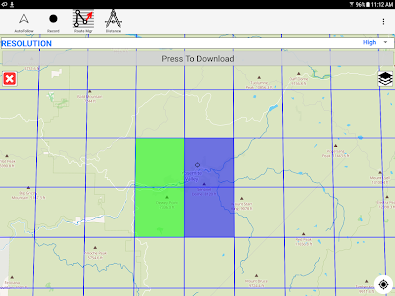
► Offline vector maps √ Easy to download offline topos
► Custom base maps √ Switch base maps between vector topos, hybrid satellite imagery and more
►GPS FEATURES √ Record Tracks √ Enter or import Waypoints. √ Auto Follow * Real Time Track Overlay * Predicted Path Vector * Course Up(Text stays upright) * Speed & Heading √ Route Assistance With Voice Prompts * Prompts when approaching a boating route marker * Continous distance & ETA updates * Alerts when off route * Alerts when moving in wrong direction
►ROUTE MANAGEMENT / TRIP PLANNING √ Create New Route/Edit Existing Routes √ Move Points √ Add points to an existing route leg √ Delete / Rename points √ Import GPX,KML & KMZ files √ Plot/Edit Routes √ Enter Waypoints √ Share/Export Routes,Tracks&Markers √ Reverse Routes
► SHARING * Share tracks/routes/markers on Facebook & Twitter * Export tracks/routes/markers as compressed GPX files.
► Topo & Trail Maps for National Parks Detailed topographic trail maps are included for national and state park including:: √ Great Smoky Mountains √ Grand Canyon √ Zion √ Rocky Mountain √ Yosemite √ Yellowstone √ Acadia √ Olympic √ Denali √ Glacier ► Weather Forecasts Animate weather forecast overlays for the following. √ Wind Speed and Directions (GFS & ECMWF) √ Wave Heights (Swell + Wind combined) and Direction(GFS & ECMWF) √ Pressure (MSL) (GFS & ECMWF) √ Precipitation √ Air Temperature (GFS & ECMWF) √ Gust √ Lake Temperatures
Comfortable Weather Settings √ Automatically Highlight Harsh Weather Forecasts √ Weather settings are customizable based on your preferences. ► Suggested Uses for i-Hunting Topo Maps
√ Hunt Planning & Recon √ Off trail and On trail hiking √ Backpacking : Use Topos of National Forests and Wilderness areas with GPS √ Snow Sports (Snow Shoeing, Skiing, Snowboarding, Snow Mobiling) √ SAR (Search and Rescue)
The i-Hunting application can turn your phone into full fledged outdoors GPS unit (like Garmin ® or Magellan ® outddor GPS). The app compliments the gear you got from Dick's ® , REI ® , Cabelas ® etc.
Whats News
-MAJOR UPDATE
-- Weather Map overlays (Wind, Wave, Pressure, Precipitation, Temperature, Gust) -- Adjust comfortable values for weather overlays -- Lake Temperature Maps -- New search algorithm that shows results as you type in
On our website, you can download the latest version of Hunting Gps Maps, Topo +Trails in APK format — fast and free! No sign-up or SMS required: direct link and verified files!


There are no comments yet :(